Underground utility locating before excavation
Underground utility locating means locating, marking on the ground and mapping all buried utilities on a property (conduits, cables, pipes, tanks, old structures) before excavation, drilling or piling work. Détection Souterraine Québec performs this survey with GSSI ground penetrating radar and electromagnetic radio detection, then delivers a PDF report with a plan and depths within 24 hours.
- PDF report within 24 hours
- Submit your Info-Excavation request for public utilities, and entrust us with the private utilities on your property.
At a glance
- Public and private utilities, metallic and non-metallic
- Ground marking according to the underground utility colour code
- PDF report with plan, estimated depths and legend
- Reply within 24 to 48 business hours, job site emergencies prioritized
- Montreal, Laval, South Shore, Châteauguay, Dorval
What underground utility locating covers
Info-Excavation locates its members' utilities (Hydro-Québec, Énergir, Bell, municipalities) up to the property line. On the private side, no one locates for you. Our service takes over for everything that belongs to the property owner.
| Utility type | Examples | Main method |
|---|---|---|
| Electrical | Building service connection, cable to a garage, outdoor lighting | Radio detection |
| Telecommunications | Fibre, coaxial cable, buried phone line | Radio detection, ground penetrating radar |
| Gas | Steel or polyethylene service line | Radio detection, ground penetrating radar |
| Water | Water service line, private water main, irrigation | Radio detection, ground penetrating radar |
| Sewer and drainage | Weeping tile, storm sewer, septic tank | Ground penetrating radar, sonde |
| Tanks and structures | Oil tank, cistern, old foundation | Ground penetrating radar |
Plastic or concrete conduits without a tracer wire do not respond to radio detection: that is where ground penetrating radar makes the difference.
How the survey works
- Preparation. You send us the area to cover, the planned work and any existing plans. We check that the Info-Excavation request has been made for the public portion.
- On-site locating. The technician sweeps the area with ground penetrating radar, then traces metallic utilities with radio detection by connecting to access points (meters, manholes, junction boxes).
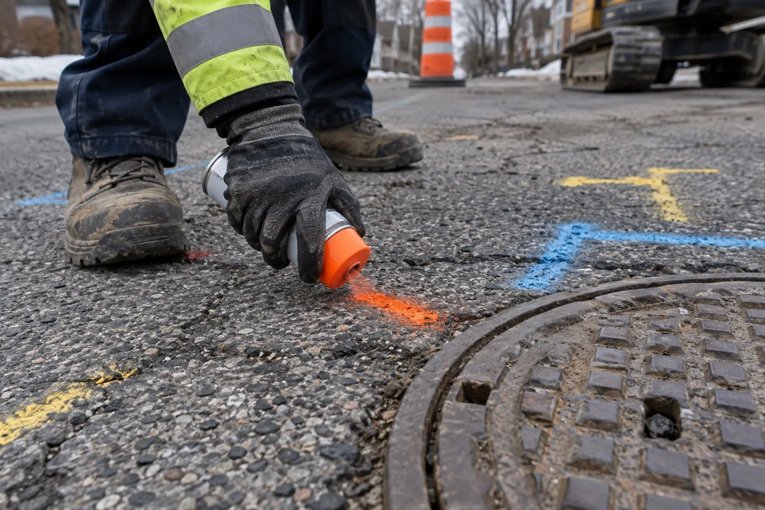
- Marking. Each utility is marked on the ground in the corresponding colour with depth markers.
- Report. You receive a PDF with the locate plan, ground penetrating radar profiles, estimated depths and areas of uncertainty.
Ground marking colour code
| Colour | Utility |
|---|---|
| Red | Electrical |
| Yellow | Gas, oil, steam |
| Orange | Telecommunications, cable television |
| Blue | Drinking water |
| Green | Sewers, drainage |
| Purple | Reclaimed water, irrigation |
| Pink | Temporary survey markings |
| White | Proposed excavation limits |
When to request this service
- Before an excavation, a trench or directional drilling on private property
- Before piles, foundations or an in-ground pool
- Before landscaping work with machinery
- When planning an addition or a new building
- When construction plans are missing or incomplete
Why choose Détection Souterraine Québec
- Two technologies on every job: ground penetrating radar and radio detection complement each other, and neither is enough on its own.
- GSSI equipment (UtilityScan for the ground, StructureScan for concrete).
- A report your crews can use the same day, with depths and areas to avoid clearly identified.
- A single visit for the ground and the concrete if your project includes a slab to drill.
Service areas
Montreal, Laval, South Shore, Châteauguay, Dorval and neighbouring municipalities.
Frequently asked questions
How much does underground utility locating cost? The cost of underground utility locating depends on the area, the number of utilities present and site access. A residential property is usually covered in a few hours. Request a quote with the city and type of work for an accurate price.
How accurate is the locating? The horizontal position of marked utilities is generally accurate to within a few centimetres. The depth is an estimate that depends on the soil; the report flags areas of uncertainty and recommends hand digging or hydro-excavation near the utilities.
Do you replace Info-Excavation? No, the two are complementary. Submit your Info-Excavation request for public utilities, and entrust us with the private utilities on your property.
Do you handle emergencies? Yes. Write "job site emergency" in your request or call us; we prioritize jobs where a crew is waiting to excavate.
What our clients say
“Before digging for our pool, they marked everything on the ground. We dug with peace of mind!” (translated from French)
Client, Laval · In-ground pool
“Clear plan received the next day. Our operators knew exactly where to dig!” (translated from French)
Client, South Shore · Construction site
Resources on this service
All resourcesGround penetrating radar (GPR) to see underground without digging
Learn how ground penetrating radar detects conduits, tanks and voids underground without digging, with its real depth range in Quebec and its limits.
Info excavation Quebec for digging safely in the capital
Learn how to combine info excavation Quebec with a private GPR survey to dig safely despite shallow bedrock and aging utilities in Quebec City.
Schedule your underground utility locating
Send us the city, the approximate area and the type of work. We will get back to you within 24 to 48 business hours with a quote and a date for the visit.
- PDF report within 24 hours
- Submit your Info-Excavation request for public utilities, and entrust us with the private utilities on your property.